The map above shows you where the snow will occur with the storm. The Northeast will take the brunt of the snow with over 6 inches from New York into Maine. If you at the pattern the next couple of weeks, that area may get hit several more times by major snow events.
 Severe storms will hit the Southeast this afternoon. There is a potential for tornado activity as we saw yesterday across parts of Mississippi. The rotation tracks from the HRRR model shows potential tornadoes from Georgia up into the Carolina’s.
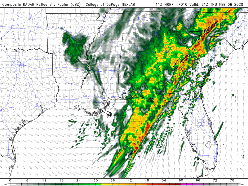
The Simulated radar shows the line of storms with supercells in front of the line this afternoon.
Please Share My Blog to all your friends:
Like this:
Like Loading...
