Most of the Northeast and Mid-Atlantic Mets have now picked up on the high wind event that is coming Thursday evening into Friday morning.
 Even the Storm Prediction Center has upgraded the severe weather risk to an Enhanced Risk of severe weather. This event was predicted two days ago on this site and my clients were given a heads-up for the event so they could prepare.
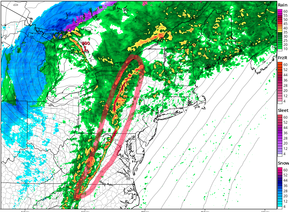
As for the event, I have no real changes. The cold front will blast through the Mid- Atlantic and Northeast and a line of low-topped thunderstorms or convection will develop ahead of the cold front and will enhance the wind gusts up to perhaps 70 mph. There’s even the chance for some quick spin-up tornadoes in storms ahead of the line and along the line.
 There’s been a lot of talk about Trick or Treat time and the storms. I outlined an area where the storms will occur during the 6pm to 8pm time period, so as parents, use your best judgement on sending kids out into the weather. Know that trees and tree branches might come down in the high winds so have a game plan.
I added the helicity tracks to show where some of the storms may rotate and produce tornadoes. That is below.

