This week the weather will shift into the East after giving the West heavy snow. More snow will occur across the West through tomorrow but the snows will be winding down after tomorrow.
The next storm may bring some snow to the Northeast and eastern New England Wednesday night into Thursday. There is the chance the coastal storm intensifies enough to produce snow across eastern New England Thursday.
The next storm this weekend will most likely bring snow to the Western Great Lakes and the Northeast. While some of the models still have snow as far south as southern PA and NJ, the trend has been for the bulk of the snow to be north of I-90 in the Northeast.
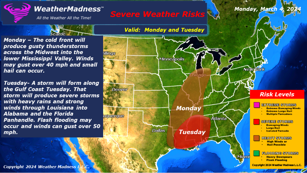
Severe Weather: Monday – The cold front will produce gusty thunderstorms across the Midwest into the lower Mississippi Valley. Winds may gust over 40 mph and small hail can occur.
Tuesday- A storm will form along the Gulf Coast Tuesday. That storm will produce severe storms with heavy rains and strong winds through Louisiana into Alabama and the Florida Panhandle. Flash flooding may occur and winds can gust over 50 mph.